
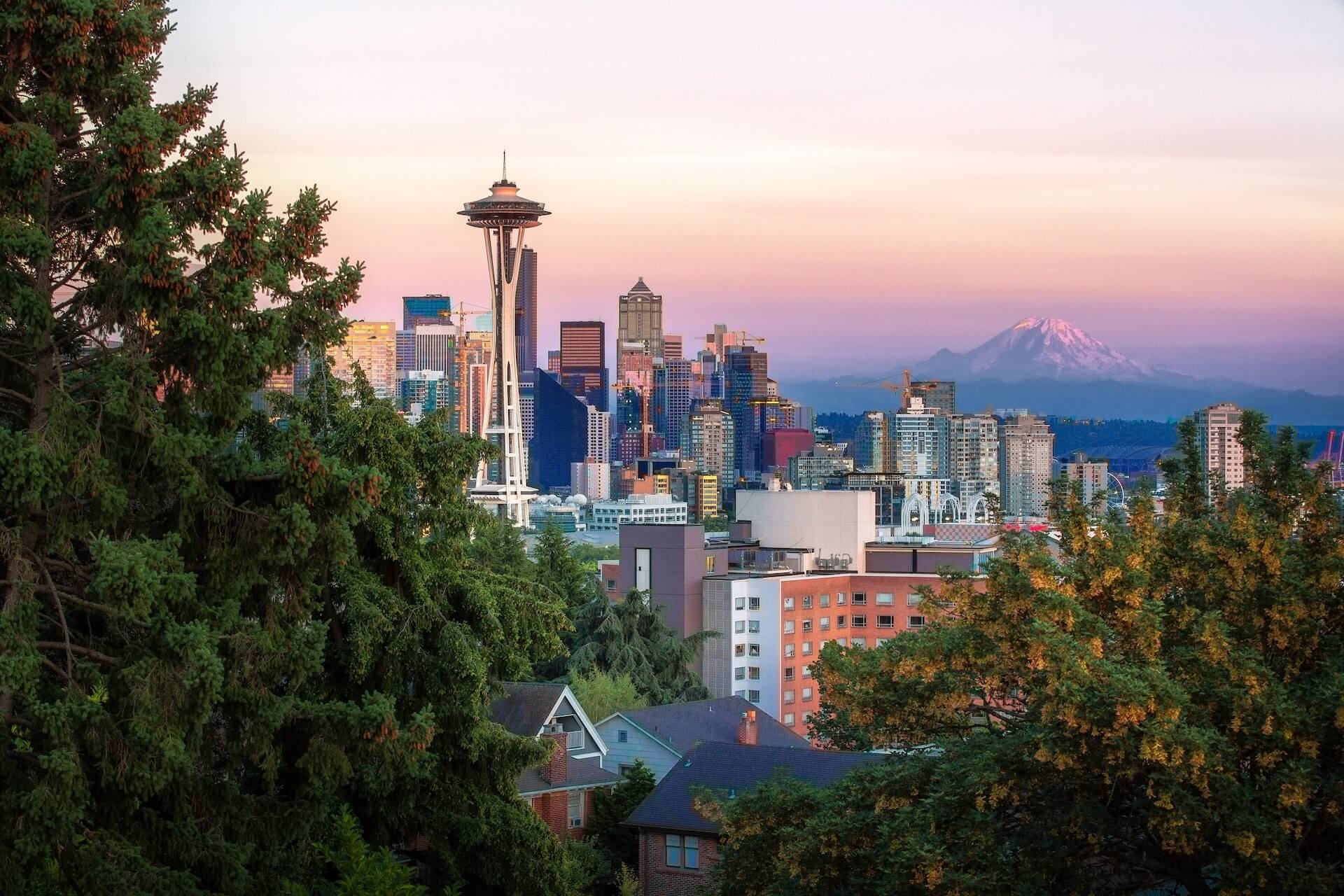
Seattle and the Puget Sound Area: A Guide to Geography, Weather, and Outdoor Life
The Puget Sound is a deep, glacier‑carved inlet of the Pacific Ocean that stretches south from the Strait of Juan de Fuca toward Olympia. It is named after Peter Puget, a lieutenant in the Vancouver Expedition who surveyed the waters in 1792. Seattle sits on the eastern shore of this sound, making the city a gateway to the surrounding waterways, islands, and lowlands.
What Is the Puget Sound?
The Puget Sound is a complex estuarine system that mixes saltwater from the ocean with freshwater from rivers such as the Snohomish, Skagit, and Puyallup. Its shoreline is indented with bays, coves, and dozens of islands, the largest being Whidbey and Bainbridge. The sound supports a rich ecosystem of salmon, orcas, seabirds, and intertidal life.
Why Is It Called Puget Sound?
The name honors Peter Puget, who first charted the southern reaches of the inlet during Captain George Vancouver’s 1792 Pacific voyage. Early maps labeled the water “Puget’s Sound,” and the name stuck as settlers and mariners used it for navigation.
Is Seattle in the Puget Sound Area?
Yes. Seattle’s city limits lie along the eastern edge of the sound, with neighborhoods such as Ballard, West Seattle, and Downtown fronting the water. The city’s harbor, Elliott Bay, is a direct arm of the Puget Sound.
What Cities Are in the Puget Sound Area?
The region includes a mix of urban centers and smaller towns. Major cities are:
- Seattle
- Tacoma
- Everett
- Bellingham
- Olympia (state capital)
- Bremerton
- Port Orchard
Numerous suburbs and unincorporated communities also dot the shoreline, from Edmonds and Mukilteo in the north to Gig Harbor and Puyallup in the south.
How Far Is Puget Sound from Seattle?
Because Seattle’s western boundary is the shoreline of Elliott Bay, the distance from downtown Seattle to the open water of the sound is essentially zero. Travel to the middle of the sound, such as to the waters off Bainbridge Island, requires only a short drive or ferry ride—typically under 30 minutes.
Geography and Natural Features
The Puget Sound lowlands are characterized by rolling hills, glacial deposits, and river valleys. To the east rise the Cascade Mountains, while the Olympic Mountains stand to the west across the water. This setting creates a mild rain shadow effect, giving the area more sunshine than the western Olympic Peninsula.
Islands within the sound provide protected harbors and recreational spots. Whidbey Island, the largest, is accessed via the Deception Pass Bridge. Bainbridge Island is reachable by a 35‑minute ferry from Seattle. Vashon Island lies between Seattle and Tacoma and is known for its rural character.
Climate and Weather
The Puget Sound region experiences a marine west‑coast climate. Winters are cool and wet, with frequent drizzle rather than heavy snow. Summers are mild and relatively dry, with daytime temperatures usually comfortable for outdoor activities. Because the water moderates temperature extremes, frost is rare near the shore.
Weather can change quickly, especially in the spring and fall. Fog often forms over the water in the morning, clearing by afternoon. Wind patterns vary; the sound can be calm in sheltered bays but breezier in exposed channels such as Admiralty Inlet.
Outdoor Activities on the Puget Sound
The water and surrounding lands support a wide range of pursuits:
- Boating and sailing: Numerous marinas, yacht clubs, and public launches cater to powerboats, sailboats, kayaks, and paddleboards.
- Fishing: Salmon runs attract anglers from shore and boat; halibut, lingcod, and rockfish are also common.
- Wildlife viewing: Orca pods, seals, sea lions, and bald eagles are frequently spotted from shorelines or tour boats.
- Hiking and biking: Trails such as the Elliott Bay Trail, the Burke‑Gilman Trail, and the Island County trail network offer scenic routes with water views.
- Beachcombing and tide pooling: Public beaches at Alki, Golden Gardens, and Discovery Park reveal intertidal life at low tide.
Maps and Navigation
Accurate mapping is essential for safe travel on the sound. The National Oceanic and Atmospheric Administration (NOAA) provides nautical charts that detail depths, currents, and navigation aids. For land‑based exploration, the Washington State Department of Transportation and local county GIS sites offer printable and interactive maps showing roads, trails, and public access points.
Many smartphone apps combine NOAA chart data with real‑time AIS (Automatic Identification System) vessel tracking, helping boaters avoid traffic and stay within marked channels.
Common Questions About the Region
Visitors and newcomers often ask:
- What is the tidal range? The Puget Sound experiences mixed semidiurnal tides, with typical ranges of 8 to 12 feet depending on location and lunar phase.
- Are there any dangerous currents? Narrow passages such as Deception Pass and the Tacoma Narrows can develop strong tidal currents, especially during peak flow. Boaters should consult tide tables and local notices.
- Is the water safe for swimming? Designated swimming beaches are monitored for bacteria levels. After heavy rain, runoff can temporarily raise bacteria counts, so heed any posted advisories.
- Can I camp on the islands? Several state and county parks offer campsites, including Fort Worden on the Olympic Peninsula and Fay Bainbridge Park on Bainbridge Island. Reservations are recommended in summer.
Practical Insights for Visitors
To make the most of your time in the Puget Sound area:
- Check the marine forecast before heading out; wind and wave conditions can shift rapidly.
- Dress in layers. Even on sunny summer days, a light windbreaker is useful near the water.
- Respect wildlife viewing distances—stay at least 100 yards from orcas and 50 yards from seals.
- Leave no trace. Pack out all trash, especially when visiting remote shorelines or islands.
- If you plan to fish, verify current regulations with the Washington Department of Fish and Wildlife, as seasons and limits change yearly.
Mistakes to Avoid
Common pitfalls include:
- Underestimating the speed of tidal currents in narrow channels.
- Assuming that all shorelines are public; many waterfront properties are private.
- Neglecting to carry a VHF radio or a charged cell phone when boating beyond sight of shore.
- Overlooking the need for a fishing license when harvesting shellfish or finfish.
- Ignoring tide times when exploring tide pools, which can lead to being stranded by incoming water.
Frequently Asked Questions
- What is the Puget Sound and why is it called that?
- The Puget Sound is a glacier‑formed saltwater inlet of the Pacific Ocean, named after Lieutenant Peter Puget who surveyed it in 1792.
- Is Seattle in the Puget Sound area?
- Yes. Seattle’s eastern shoreline borders Elliott Bay, which is part of the Puget Sound.
- What cities are in the Puget Sound area?
- Major cities include Seattle, Tacoma, Everett, Bellingham, Olympia, and Bremerton, along with many smaller towns and suburbs.
- How far is Puget Sound from Seattle?
- Seattle sits directly on the sound’s eastern edge, so downtown is essentially at the water’s edge; reaching the middle of the sound takes a short drive or ferry ride.
- What kind of weather can I expect?
- The region has a mild marine climate: cool, wet winters and mild, dry summers with moderate temperatures year‑round.
- Are there any safety concerns for boaters?
- Strong tidal currents in narrow passages, rapidly changing weather, and heavy commercial traffic require attention to tide tables, marine forecasts, and proper communication equipment.